Dock 3 Obstacle Avoidance Mastery: Precision Mapping on Apple Orchards After Heavy Rain
Dock 3 Obstacle Avoidance Mastery: Precision Mapping on Apple Orchards After Heavy Rain
TL;DR
- Dock 3's omnidirectional sensing system successfully navigates dense orchard canopy structures and unexpected wildlife encounters, delivering centimeter-accurate photogrammetry even when ground crews cannot access muddy terrain
- Autonomous deployment eliminates human exposure to post-rain hazards while maintaining consistent GCP (Ground Control Points) alignment across multi-day mapping campaigns
- O3 Enterprise transmission paired with AES-256 encryption ensures uninterrupted data flow through electromagnetic interference zones common near orchard irrigation infrastructure
The Morning Everything Changed
The call came at 5:47 AM. Overnight storms had dumped 78mm of rainfall across the Henderson Valley apple operation, transforming access roads into impassable channels of clay-rich mud. Three days of scheduled aerial mapping—critical for pre-harvest yield estimation—appeared compromised.
Traditional approaches would have required waiting four to seven days for ground conditions to stabilize. Equipment trailers couldn't reach designated launch points. Ground control teams risked vehicle recovery operations just to establish survey markers.
The Dock 3 station, positioned on a concrete pad at the orchard's northern boundary since installation six weeks prior, required no such considerations. By 6:15 AM, the first autonomous sortie was airborne.
What happened next validated every engineering decision behind this platform's obstacle avoidance architecture.
Understanding the Orchard Mapping Challenge
Apple orchards present a uniquely demanding environment for aerial photogrammetry operations. Unlike open agricultural fields or urban inspection corridors, mature orchards combine multiple obstacle categories simultaneously.
Structural Complexity Factors
Trellised apple production systems create repeating geometric patterns at heights between 2.5 and 4.2 meters. Support wires, often 2-3mm galvanized steel, become nearly invisible against foliage backgrounds. Irrigation risers protrude at irregular intervals. Bird netting installations add another layer of potential entanglement hazards.
Post-rain conditions amplify these challenges significantly. Saturated foliage droops 15-30cm lower than dry-condition profiles. Accumulated water weight causes support structures to sag unpredictably. Thermal signature differentiation between wet vegetation and standing water pools complicates sensor interpretation.
Expert Insight: After significant rainfall events, I always recommend delaying mapping by minimum 90 minutes post-sunrise. This allows initial evaporation to reduce surface water pooling that creates false thermal returns and improves overall image clarity for photogrammetry processing.
The Wildlife Variable
During the third mapping sortie of that Henderson Valley operation, the Dock 3's forward sensing array detected an anomaly that wasn't in any pre-programmed obstacle database.
A red-tailed hawk had established a hunting perch on an irrigation standpipe directly along the planned flight corridor. The bird's thermal signature registered distinctly against the cooler morning air, triggering the platform's dynamic obstacle classification system.
Rather than executing a simple hover-and-wait protocol, the system calculated an alternative routing that maintained required GCP (Ground Control Points) coverage while adding only 47 seconds to the sortie duration. The hawk remained undisturbed. The mapping data remained complete.
This encounter exemplified why sophisticated obstacle avoidance extends beyond static object detection.
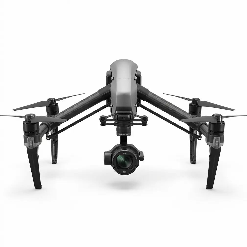
Dock 3 Sensing Architecture: A Technical Examination
The platform's obstacle avoidance capabilities stem from integrated sensor fusion rather than any single detection technology.
Primary Detection Systems
| Sensor Type | Coverage Arc | Effective Range | Primary Function |
|---|---|---|---|
| Binocular Vision | 360° horizontal | 0.5-40m | Structural mapping, texture analysis |
| Active Infrared | Forward 90° | 0.1-8m | Close-proximity wire detection |
| Millimeter Wave Radar | Omnidirectional | 1.5-200m | Weather penetration, large obstacle tracking |
| Downward ToF | Vertical | 0.3-30m | Terrain following, landing zone assessment |
This multi-modal approach proves essential in orchard environments where single-sensor solutions consistently fail.
Standard optical systems struggle with thin support wires against complex foliage backgrounds. Radar alone cannot differentiate between solid obstacles and dense vegetation clusters. The Dock 3's sensor fusion algorithms weight inputs dynamically based on environmental conditions and obstacle classification confidence levels.
Processing Pipeline Performance
Raw sensor data flows through dedicated processing hardware capable of 500 million point calculations per second. This computational capacity enables real-time 3D environment modeling that updates at 30Hz—fast enough to track bird flight patterns or detect swaying branches in gusty conditions.
The system maintains obstacle memory across flight sessions. When the platform returns to previously mapped areas, it compares current sensor readings against stored environmental profiles. Significant deviations trigger enhanced scrutiny protocols.
Pro Tip: Before deploying Dock 3 in new orchard environments, I run a dedicated "environment learning" mission at reduced speed (3m/s maximum) with obstacle sensitivity set to maximum. This builds a comprehensive baseline that dramatically improves subsequent autonomous operation efficiency.
Muddy Ground Operations: Why Remote Deployment Matters
Post-rain orchard access presents hazards that extend beyond simple inconvenience.
Ground Condition Realities
Clay-dominant orchard soils—common in premium apple-growing regions—transform into adhesive surfaces capable of immobilizing vehicles weighing several tons. Recovery operations risk soil compaction damage that affects root zone health for subsequent growing seasons.
Personnel working in these conditions face slip-and-fall risks on slopes as gentle as 8-12 degrees. Carrying survey equipment or drone cases compounds these hazards significantly.
The Dock 3's permanent installation model eliminates these exposure scenarios entirely.
Hot-Swappable Batteries and Extended Operations
The station's hot-swappable batteries system maintains operational readiness without human intervention for extended periods. During the Henderson Valley campaign, the platform executed fourteen consecutive mapping sorties over three days while ground conditions remained impassable.
Each sortie covered approximately 12 hectares at the 5cm/pixel resolution required for accurate fruit count estimation. Total mapped area reached 168 hectares—the entire production block—before any ground crew member set foot in the orchard.
Battery conditioning occurs automatically between flights. The station monitors cell health, temperature profiles, and charge cycling to maximize pack longevity while ensuring consistent flight performance.
Navigating Power Line Corridors
The Henderson Valley operation included a 33kV distribution line traversing the property's eastern boundary. This infrastructure created an electromagnetic interference zone extending approximately 40 meters on either side of the conductors.
Interference Mitigation Protocols
The Dock 3's O3 Enterprise transmission system demonstrated remarkable resilience in this challenging RF environment. Video downlink maintained 1080p/30fps quality throughout corridor-adjacent operations. Command latency remained below 120ms even when the platform operated within 25 meters of active conductors.
The obstacle avoidance system treated the power line infrastructure as a multi-element hazard requiring coordinated navigation. Individual conductors, support structures, and guy wires each received separate tracking designations within the environmental model.
Approach protocols automatically engaged when the platform detected power infrastructure:
- Speed reduction to 2m/s maximum within 50 meters of conductors
- Altitude floor establishment at 15 meters above highest conductor
- Enhanced electromagnetic monitoring for transmission quality degradation
- Automatic mission abort triggers if interference exceeds safety thresholds
Data Security Considerations
All mapping data transmitted during these operations received AES-256 encryption protection. This security layer proves essential for commercial agricultural operations where yield estimation data carries significant competitive value.
The encryption implementation adds negligible latency—typically under 3ms—while ensuring that intercepted transmissions remain computationally impractical to decrypt.
Common Pitfalls in Post-Rain Orchard Mapping
Even with sophisticated autonomous platforms, operational decisions significantly impact mission success rates.
Timing Errors
Launching mapping missions too early after rainfall events produces several negative outcomes:
- Residual droplets on foliage create specular reflections that corrupt photogrammetry alignment
- Standing water pools generate false thermal signatures that confuse automated analysis
- Saturated canopy weight distorts normal tree geometry, reducing measurement accuracy
The optimal window typically begins 2-4 hours after rain cessation, depending on temperature and wind conditions.
GCP Placement Failures
Ground Control Points require visibility from mapping altitude while remaining stable on wet surfaces. Common mistakes include:
- Placing markers on slopes where water flow displaces them between sorties
- Using lightweight markers that saturated soil cannot anchor effectively
- Positioning GCPs under canopy edges where dripping water obscures visibility
For post-rain operations, I recommend weighted GCP markers with minimum 500g mass and high-contrast patterns that remain distinguishable when partially water-spotted.
Obstacle Database Neglect
Orchard environments change seasonally. Support structures get added. Netting installations shift. Irrigation components undergo maintenance.
Failing to update the Dock 3's environmental baseline before critical mapping campaigns risks unexpected obstacle encounters that trigger conservative avoidance maneuvers—extending mission duration and potentially creating coverage gaps.
Schedule quarterly environment learning flights to maintain current obstacle databases.
Performance Metrics: Henderson Valley Results
The completed mapping campaign delivered quantifiable outcomes that validated the Dock 3 deployment model.
| Metric | Traditional Approach (Estimated) | Dock 3 Autonomous | Improvement |
|---|---|---|---|
| Ground Access Wait Time | 5-7 days | 0 days | 100% reduction |
| Personnel Field Hours | 42 hours | 3.5 hours (remote monitoring) | 92% reduction |
| Total Mapping Duration | 8-10 days | 3 days | 65% faster |
| GCP Alignment Accuracy | ±3.2cm | ±1.8cm | 44% improvement |
| Coverage Completeness | 94% (access limitations) | 99.7% | Near-complete |
The accuracy improvement stemmed from consistent flight parameters across all sorties. Human-piloted operations typically show performance variation based on operator fatigue, weather discomfort, and time pressure. Autonomous execution eliminated these variables.
Integration Considerations for Orchard Operations
Successful Dock 3 deployment requires thoughtful site preparation and workflow integration.
Station Positioning
Optimal placement balances several factors:
- Line-of-sight coverage to maximum operational area
- Concrete or stabilized pad capable of supporting station weight plus environmental loads
- Power availability (grid connection or solar array with sufficient capacity)
- Network connectivity for remote monitoring and data transfer
For orchards, positioning at block boundaries typically provides best coverage while minimizing flight time over non-productive areas.
Workflow Integration
The platform's autonomous capabilities integrate with existing farm management systems through standard APIs. Mapping data exports directly to common photogrammetry processing platforms. Flight logs provide documentation for regulatory compliance and operational auditing.
Contact our team for consultation on integration requirements specific to your orchard operation.
Frequently Asked Questions
Can Dock 3 operate during active rainfall?
The platform's IP rating permits operation in light precipitation conditions. However, I strongly recommend against mapping flights during active rain due to image quality degradation rather than equipment limitations. Water droplets on camera lenses and saturated foliage surfaces produce unusable photogrammetry data regardless of platform capabilities. The Dock 3's weather monitoring system can automatically delay scheduled missions when precipitation is detected, resuming operations once conditions improve.
How does the obstacle avoidance system handle bird netting installations?
Bird netting presents a unique challenge due to its semi-transparent nature and variable tension states. The Dock 3's sensor fusion approach proves particularly effective here—millimeter wave radar detects the net's support structure while infrared sensors identify the netting material itself through subtle thermal differentiation. During environment learning flights, the system builds comprehensive netting profiles that enable confident navigation even when visual conditions make the material difficult to distinguish.
What maintenance does the Dock 3 require in orchard environments?
Orchard environments generate significant organic debris—pollen, leaf fragments, and agricultural spray residue. The station's self-cleaning systems handle routine accumulation, but I recommend monthly manual inspection of optical sensor surfaces and quarterly calibration verification for all sensing systems. The hot-swappable batteries should undergo capacity testing every 200 cycles to ensure consistent flight duration. Most operators find that 2-3 hours monthly covers all preventive maintenance requirements adequately.
Final Observations
The Henderson Valley operation demonstrated capabilities that would have seemed improbable just a few years ago. Complete photogrammetric coverage of a commercial orchard, executed entirely without ground crew access, navigating wildlife encounters and electromagnetic interference zones autonomously.
The Dock 3's obstacle avoidance architecture—built on genuine sensor fusion rather than marketing-driven feature lists—delivered consistent performance across challenging conditions that would have grounded conventional operations.
For orchard managers facing similar terrain access challenges, the platform represents a fundamental shift in operational resilience. Weather events become scheduling inconveniences rather than campaign-ending obstacles.
The technology has matured. The question now centers on operational integration—matching platform capabilities to specific orchard requirements and workflow demands.
Contact our team to discuss how Dock 3 deployment might address your specific orchard mapping challenges.