How I’d Use the Inspire 3 to Capture Forests in Complex Terr
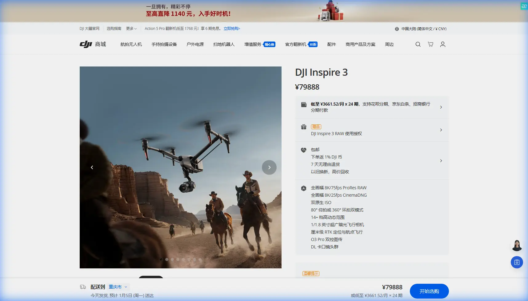
How I’d Use the Inspire 3 to Capture Forests in Complex Terrain
META: A specialist-led guide to using Inspire 3 in forest environments, covering transmission reliability, antenna adjustment, thermal context, photogrammetry discipline, hot-swap battery workflow, and field-ready measurement habits.
Forests are hard on aircraft and harder on data.
People tend to focus on the obvious obstacles first: trunks, canopy gaps, ridgelines, changing light. Those matter. But when I plan an Inspire 3 operation in steep or wooded terrain, I worry just as much about the invisible problems—signal behavior around dense biomass, electromagnetic interference near utility corridors or survey equipment, and the slow accumulation of small measurement errors that can ruin a mapping set or make a thermal comparison meaningless.
I’m writing this from the perspective of a field operator who cares about image quality, repeatability, and getting home with usable data. The Inspire 3 is a strong platform for that kind of work, especially when the mission combines cinematic capture with documentation, environmental survey, or terrain-based photogrammetry. But the aircraft alone does not solve forest complexity. Procedure does.
Start with the mission, not the camera
“Capturing forests” can mean very different things.
One team may need dramatic low-altitude tracking shots through a valley at dawn. Another may be documenting canopy stress, drainage issues, erosion edges, or access routes for conservation planning. A third may be building a photogrammetric model of a forest road or cut block using GCPs to control drift across uneven ground.
Those are different jobs, even if they all use the same airframe.
With Inspire 3, my first step is to define whether the output is:
- visual storytelling,
- technical site documentation,
- photogrammetry,
- thermal comparison work,
- or a hybrid mission.
That decision changes everything downstream: flight path, altitude discipline, speed, overlap, ground control strategy, and how aggressively I protect transmission quality.
Forest terrain punishes weak transmission habits
The most common field mistake I see is assuming a clean signal in open takeoff space means the route itself will stay clean.
It often won’t.
Trees absorb and scatter radio energy. Slopes change line-of-sight faster than operators expect. Wet vegetation can worsen signal behavior. Add localized electromagnetic noise from infrastructure, handheld devices, temporary field stations, or even poorly managed equipment clusters, and your confidence can evaporate halfway into a run.
This is where O3 transmission performance is valuable, but not magical. In forest terrain, reliability still depends on operator discipline.
My practical method for handling electromagnetic interference
If I suspect interference or see instability developing, I do not just keep pushing and hope the link settles. I make a structured adjustment:
Pause the mission and re-establish geometry
I look at terrain masking first. The issue is often less about brute interference and more about the aircraft slipping behind a ridge shoulder or denser canopy band.Adjust controller antenna orientation deliberately
This sounds basic, but it is often done poorly. Antennas should be aligned to optimize the broadside relationship to the aircraft’s position, not pointed at it like a finger. In side-slope operations, a small stance change by the pilot can noticeably improve consistency.Move the pilot station before moving the aircraft farther
A ten-meter relocation to a cleaner line of sight can be worth far more than any in-air improvisation.Reduce complexity during the unstable segment
If I’m combining a demanding camera move with a marginal link area, I simplify. Straighten the route. Reduce speed. Increase altitude margin if safe and mission-appropriate.Separate EMI suspicion from obstruction reality
Not every signal drop is electromagnetic interference. Forest work creates many false diagnoses. The correction is to test from a slightly different ground position and observe whether the issue is directional and terrain-linked.
That process matters operationally because it protects both the aircraft and the dataset. A ruined transmission segment can break continuity in a visual sequence, create missing coverage in a mapping pass, or force a rushed reposition that compromises safety.
Measurement discipline matters more than most drone crews admit
This is where the reference material behind aircraft design and engineering practice becomes surprisingly useful.
One source highlights non-preferred conduit diameters in fluid systems—DN 14, 18, 22, 28, 36, 45, 56, 70, and 90—and notes that dimensional values are based on the fully assembled condition, including metal width, liner, or outer covering. Another provides unit conversion tables for thermal properties, including values such as 4186.8 J/(kg·K) and a heat-flux conversion factor of 0.271246 in the table excerpt.
At first glance, that has nothing to do with Inspire 3 forest work. In practice, it points to two habits that absolutely do.
1. Avoid “almost standard” field assumptions
The design handbook’s warning that certain sizes are not preferred is a reminder that engineering systems work best when you stay inside known, standardized ranges. In drone operations, the equivalent mistake is inventing your own half-standard mission geometry in the field.
Examples:
- inconsistent overlap because the terrain “looks fine,”
- ad hoc altitude changes with no logging,
- GCP spacing that drifts from plan because the slope is inconvenient,
- mixed thermal reference timing between separate flights.
These are the aerial survey versions of choosing awkward, non-preferred dimensions in a physical system. They create friction, reduce interoperability, and make downstream processing harder than it should be.
When using Inspire 3 for photogrammetry in forest terrain, I recommend resisting improvisation unless conditions truly require it. Set a repeatable flight logic and stick to it. Terrain is already introducing enough uncertainty.
2. Know your units before you trust your thermal story
The unit-conversion material matters because thermal interpretation gets sloppy very quickly when crews mix conventions without noticing.
If you are comparing thermal signature behavior across a forest edge, wetland margin, road cut, or stressed canopy patch, you need consistent environmental notes and a clean understanding of what your readings represent. The engineering reference’s conversion structure—moving between systems like Btu-based and SI-based thermal quantities—underscores a simple truth: when units drift, conclusions drift.
In the field, that means:
- record ambient conditions consistently,
- document time offsets between flights,
- note whether surfaces were sunlit, shaded, wet, or wind-exposed,
- avoid comparing thermal captures from different mission windows as if they were directly equivalent.
For environmental or infrastructure-adjacent forest work, thermal signature can be useful. But only if you treat it as measured evidence, not dramatic color.
Hot-swap batteries are a workflow advantage, not just a convenience
Inspire 3’s hot-swap battery capability is one of those features that sounds mundane until you’re operating on a narrow forest access road with changing cloud, short weather windows, and a team waiting on continuity.
The practical value is not simply that battery replacement is faster. It’s that your entire mission rhythm becomes more coherent.
For complex terrain work, I use hot-swap capability in three ways:
Preserve continuity in repeat passes
If I need matching light angle or tightly grouped survey segments, reducing turnaround time matters.Reduce rushed handling
Forest sites are rarely ideal launch environments. Mud, roots, uneven gravel, and limited flat staging areas all increase the chance of mistakes during hurried resets.Keep the aircraft warm in cold or damp conditions
Depending on climate and season, minimizing unnecessary idle downtime can help maintain smoother operational flow.
This is particularly important when collecting overlapping imagery for photogrammetry. Long interruptions increase environmental variation. Shadows shift. Wind patterns change. Moisture levels on foliage evolve. Your dataset stops being one mission and starts becoming a patchwork.
Photogrammetry in forests: where Inspire 3 helps and where the forest still wins
Let’s be honest: dense forest is not the easiest environment for photogrammetry. Canopy movement, poor ground visibility, repeated textures, and steep relief all work against clean reconstruction.
So why use Inspire 3 here?
Because for the right target area—roads, clearings, landslide margins, stream crossings, cutlines, canopy breaks, habitat edges, or mixed open/wooded corridors—it gives you a highly controllable platform for disciplined image collection and stable route execution.
My baseline approach
For a forest-adjacent mapping task, I would:
- establish clear mission boundaries around what must actually be modeled,
- place GCPs only where they are visible and defensible,
- avoid pretending ground control inside dense canopy will solve hidden-surface problems,
- maintain conservative overlap,
- keep altitude logic tied to terrain, not launch point convenience,
- separate pure mapping passes from creative footage runs.
That last point matters. A beautifully flown cinematic route is rarely the same thing as a robust photogrammetry capture. Trying to combine them in one pattern usually weakens both outputs.
AES-256 and why secure transmission still matters in civilian work
Forest operations often involve more than pretty landscapes. You may be documenting private land, industrial corridors, environmental survey zones, or early-stage development areas. Secure transmission is therefore not just a corporate checkbox.
AES-256-level protection has real operational significance when your flight feed, site visuals, and captured mission context may contain sensitive commercial information. In practical terms, this is about protecting client confidentiality and project integrity during professional field operations.
For civilian teams doing inspection, land management, or environmental analysis, that matters. It supports trust. It also helps separate professional practice from hobby-level casualness.
BVLOS conversations need discipline
A lot of operators casually mention BVLOS when discussing large forest areas. I prefer caution here.
Complex terrain is exactly where people overestimate what distance capability means in real operating conditions. Trees, ridges, and line-of-sight limitations do not care how impressive the aircraft spec sheet looks. If your regulatory framework, visual procedures, or communications setup are not aligned for that mission profile, then stretching the envelope is not professionalism. It is poor judgment with good branding.
For legal, planned, properly supported operations, broader-area workflows can make sense. But in many forest missions, smarter pilot placement and segmented flight design produce better results than simply trying to cover everything from one launch point.
A field sequence I trust
If I were sending a crew into complex forest terrain with Inspire 3 tomorrow, I’d keep the sequence simple and strict:
1. Recon the terrain physically
Walk the takeoff zone, identify ridge masking, and mark likely signal trouble sectors.
2. Choose a pilot station for line-of-sight, not comfort
The best standing point is often not the flattest or most convenient one.
3. Define output priority
Cinematic, photogrammetric, or thermal-led. Pick the primary objective before props spin.
4. Build repeatable route logic
Avoid “we’ll adapt as we go” unless the mission truly demands dynamic capture.
5. Prepare for antenna adjustments
Treat transmission posture as an active part of the job, especially near terrain transitions.
6. Use hot-swap to protect continuity
Keep mission segments tight in time.
7. Log environmental context
For thermal signature interpretation or repeat documentation, notes matter almost as much as imagery.
8. Secure data handling
Transmission security and file discipline should be normal practice, not an afterthought.
If your team is refining this kind of forest workflow, you can also message our flight specialists here to discuss mission planning details and operator setup.
What makes Inspire 3 especially useful here
Not every aircraft rewards disciplined operation equally. Inspire 3 does.
In complex forest terrain, that shows up in the way the platform supports intentional flying rather than compensating for sloppy planning. O3 transmission helps when used intelligently. Hot-swap batteries help preserve continuity. Secure transmission standards support professional handling of sensitive site imagery. And the aircraft’s broader capability profile makes it viable for teams that need both polished visual output and technically credible data collection.
But the deeper lesson from the reference material is this: precision in aviation systems rarely comes from heroic improvisation. It comes from respecting standards, understanding measurements, and knowing which variables can be controlled before the aircraft leaves the ground.
That mindset is what turns a difficult forest mission into a repeatable one.
Ready for your own Inspire 3? Contact our team for expert consultation.