Inspire 3 on Coastal Power Line Shoots: What Actually
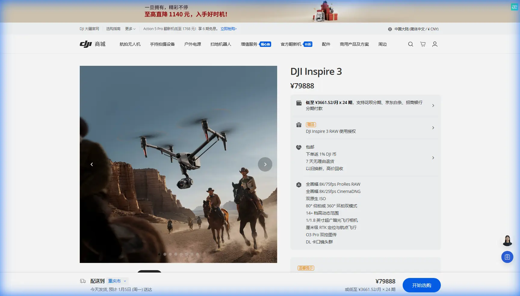
Inspire 3 on Coastal Power Line Shoots: What Actually Matters in the Field
META: A specialist case study on using Inspire 3 for coastal power line filming, with practical insight on signal reliability, navigation precision, data protection, hot-swap workflow, and real-world operational decisions.
When people talk about filming infrastructure with the Inspire 3, they often jump straight to camera specs. That misses the harder part of the job.
On a coastal power line assignment, the real challenge is not simply getting cinematic footage. It is maintaining positional confidence near long linear assets, preserving a stable command link in a reflective RF environment, managing battery cycles without losing the day to downtime, and collecting imagery that can serve more than one department after the aircraft lands. In practice, the best Inspire 3 missions are not just beautiful. They are operationally disciplined.
I’ll frame this through a recent style of mission scenario: coastal transmission lines, humid air, salt exposure, shifting wind, and a mixed deliverable set that included visual footage, inspection-oriented passes, and image sequences suitable for photogrammetry review. That combination is where the Inspire 3 starts to show its value—and where weak planning shows up fast.
Why coastal power line work is harder than it looks
Power line filming over coastal terrain produces a strange blend of conditions. The route is usually simple on paper: follow the line, document structures, capture hardware, and build enough coverage for engineers and communications teams. But the environment pushes every subsystem.
Salt-heavy air affects maintenance planning. Wind funnels around towers and escarpments. Bright water below creates visual complexity. RF noise and reflections can complicate transmission behavior. If you are trying to keep clean framing while holding safe offsets from conductors, the aircraft’s flight confidence matters just as much as its imaging quality.
This is also why I think broader aviation systems thinking still has relevance when evaluating a professional UAV workflow. One of the source references discusses microwave landing systems as a response to shortcomings in older instrument landing approaches. The details are from crewed aviation, not drones, but the engineering lesson translates cleanly: when a guidance system offers better resistance to interference, a wider usable guidance envelope, and more precise signal handling, operations become more dependable under pressure.
That reference cites MLS operating in the 5031 to 5091 MHz range and highlights why it improved on ILS: smaller antennas, stronger anti-interference performance, a larger guidance range, and up to 200 selectable channels instead of 40. For Inspire 3 users, the point is not that the aircraft carries an MLS receiver. It doesn’t. The point is that professional flight work lives or dies on signal integrity and guidance confidence. In a coastal corridor where reflections and environmental clutter can erode trust, robust transmission architecture is not a luxury feature. It is what keeps the pilot focused on separation, framing, and mission continuity instead of fighting the link.
That is one reason O3 transmission deserves more attention than it usually gets in marketing summaries. On a power line mission, a stable downlink is not just about seeing the shot. It supports safer stand-off positioning, smoother coordination between pilot and camera operator, and better decision-making when the aircraft is moving parallel to structures for extended periods.
The Inspire 3 advantage is really about workflow continuity
The Inspire 3 is most useful when the assignment is too technical for a compact camera drone and too dynamic for a heavily customized industrial platform. Coastal utility filming often sits right in that middle.
You may be tasked with three outputs in one deployment:
- polished video for stakeholder communications,
- close visual documentation of insulators, fittings, and tower geometry,
- overlapping image capture that can support photogrammetry and line-corridor review.
That is where the aircraft’s design matters. Not because it does one thing brilliantly, but because it can move between tasks without becoming a logistics burden.
Hot-swap batteries are a good example. This sounds like a convenience item until you are working in gusty coastal conditions with narrow weather windows and strict access scheduling. Then it becomes a throughput issue. If the aircraft can be turned around quickly, you preserve crew rhythm and keep continuity in light, wind, and tide conditions. That directly affects the consistency of your footage and the quality of your repeatable inspection passes.
For linear assets, mission tempo matters. A stop-start workflow introduces gaps in coverage, inconsistent shadows, and greater fatigue for both flight crew and spotters. The Inspire 3’s hot-swap battery setup helps avoid that. It reduces the dead time that quietly destroys field efficiency.
A real-world reminder: sensors are not there for marketing copy
During one coastal line shoot, the most memorable moment was not a tower reveal or a sunrise tracking pass. It was a wildlife interruption.
A white-bellied sea eagle crossed the corridor from the shoreline side just as we were repositioning for a pass on a suspension tower. It did not strike or aggressively approach, but it entered the airspace close enough that the crew had to break the shot immediately and climb out of the line track. This is where people misunderstand sensor systems. Their value is not dramatic automation. Their value is giving the flight team better awareness and more time to make conservative decisions.
On utility work, wildlife encounters are not rare. Raptors use tower environments. Coastal birds can appear fast and from odd angles. A disciplined crew does not rely on automation to “solve” that. But having strong situational awareness support from the aircraft helps the team disengage smoothly, preserve separation, and restart with less confusion.
That matters operationally because every interruption has a cost. It can force re-flying segments, alter battery planning, and create continuity issues in post. On long linear routes, even a short break can ripple through the day’s capture plan.
Why power line filming should be planned like inspection, not like cinema
The biggest mistake I see with these missions is treating them as simple aerial cinematography. If the client cares about infrastructure, every shot should have secondary value.
That means designing capture passes so footage can support engineering review, vegetation context, and future comparison. It also means thinking beyond video. If you can gather image sets with sufficient overlap, your team may produce photogrammetry outputs for corridor context or structure reference. In these workflows, GCP strategy becomes part of the conversation, even when the primary brief is filming.
Not every coastal power line mission needs a formal survey framework. But if there is any chance the imagery will be reused for measurement, progress comparison, or digital asset review, then control planning should not be an afterthought. GCPs help anchor confidence in the spatial output, especially where terrain undulates and shoreline geometry can distort perception in raw visual review.
This is where the second source reference, despite being a damaged table-of-contents extract from an aircraft structural design manual, still offers a useful engineering parallel. It points repeatedly to critical stress, local instability, combined loading, bending, torsion, and shell behavior under different load cases. Again, this is not a drone manual. But it reflects the mindset infrastructure teams already use: structures are not assessed by appearance alone. They are understood through how multiple forces act together.
That same mindset should shape the aerial capture plan. A tower or line corridor should not be filmed from one flattering angle and called documented. You need passes that reveal how components sit in context, how geometry changes along the route, and where stress-related wear indicators may be easier to spot visually. Engineers think in combined effects. Drone crews should capture with that in mind.
Security and utility clients: the quiet importance of encrypted workflow
Coastal power infrastructure is civilian critical infrastructure. That changes the data conversation.
Many utility clients now care not only about what the drone can capture, but how the footage is transmitted, stored, and shared. This is one reason AES-256 matters in practical discussions. For teams moving potentially sensitive infrastructure imagery between aircraft, controller, and post-production environments, encryption is not abstract compliance language. It is part of responsible operations.
The same logic appears in the aviation reference’s discussion of air traffic beacon and discrete address systems. The details there describe the operational need for more reliable identification, organized interrogation, and cleaner communication handling within crowded environments. The DABS concept assigns each aircraft a unique address to improve surveillance reliability and reduce overlap in responses. For drone operations, the parallel is straightforward: clear, dependable system communication reduces ambiguity. In utility work, ambiguity is expensive. Sometimes it is also unacceptable.
So when an Inspire 3 operation is being designed for infrastructure filming, the conversation should include transmission resilience and data security alongside camera settings. Those are not side topics. They are part of the mission architecture.
BVLOS, line corridors, and where the Inspire 3 fits
A lot of readers will wonder whether coastal power line work automatically implies BVLOS. Sometimes it does. Often it does not. The answer depends on jurisdiction, site layout, observer deployment, terrain, and the operator’s approval framework.
What matters here is that Inspire 3 can fit into a corridor operation strategy even when the sortie itself remains conservative and tightly managed. In some organizations, the aircraft is used for segmented VLOS operations with leapfrogging crew placement. In others, it supports carefully structured corridor work under an approved framework. Either way, the mission should be designed around recoverability, communication clarity, and repeatable procedures rather than maximum range.
That may sound cautious. It should. Utility flying rewards crews who leave margin.
Thermal signature: useful, but not always the main story
Thermal signature gets mentioned frequently in infrastructure conversations, but with Inspire 3 the more realistic discussion is about mission pairing. If the coastal asset owner wants thermal diagnostics, they may be looking at a separate aircraft or a complementary workflow. That does not diminish the Inspire 3. It sharpens its role.
Its strength on these assignments is in producing highly controlled visual content, corridor perspective, close-geometry captures, and premium footage that can also support technical review. In many utility programs, that is exactly what is needed for one phase of the project. Not every aircraft must do every job.
The smarter approach is to define the data requirement first, then assign platforms. If visual fidelity, route communication, stakeholder reporting, and precise repeatable filming are the priority, Inspire 3 is a very strong fit.
What I would brief before a coastal Inspire 3 power line mission
Before launch, I would want five things settled.
First, route segmentation. Long line assets encourage overextension. Break the corridor into disciplined blocks.
Second, stand-off rules around conductors and structures. These should be predetermined, not improvised in the live shot.
Third, transmission behavior expectations. The crew should know where reflective water, terrain folds, or tower geometry may affect the operational feel of the link.
Fourth, battery turnover rhythm. Hot-swap only helps if the ground process is clean.
Fifth, post-use intent. If the imagery may feed photogrammetry, engineering review, or future comparison, capture style must reflect that from the start.
If your team is planning a similar utility filming workflow and wants a field-practical discussion rather than a brochure conversation, you can message our operations desk here: https://wa.me/85255379740
The broader takeaway
The Inspire 3 earns its place on coastal power line work not because it is flashy, but because it reduces friction in demanding conditions. Stable transmission supports safer flying decisions. Hot-swap batteries preserve sortie tempo. Strong visual capture creates value beyond marketing footage. Secure data handling aligns with utility expectations. And when the crew plans like engineers instead of content creators, the aircraft becomes far more useful.
The source material behind this discussion comes from a very different corner of aviation: microwave landing systems with 5031 to 5091 MHz operation, anti-interference advantages, and up to 200 channels; air traffic beacon logic designed to improve communication reliability; structural thinking centered on critical stress, bending, torsion, and combined loading. None of those references describe the Inspire 3 directly. What they do provide is a serious operational lens.
That lens matters. Professional drone work around infrastructure is not just about flying a camera. It is about building confidence in guidance, communication, structure-aware capture, and repeatable outcomes.
That is why the Inspire 3 remains relevant on coastal power line assignments. Not as a generic “best drone” answer, but as a disciplined tool for crews who understand what the mission really demands.
Ready for your own Inspire 3? Contact our team for expert consultation.