Inspire 3 in the Mountains: A Field Report on Filming Solar
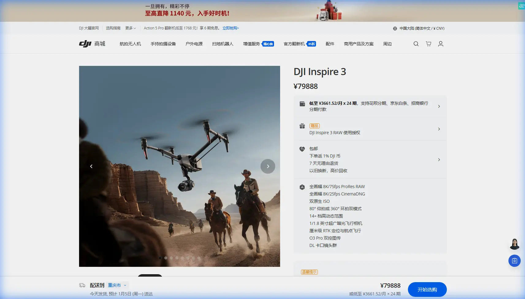
Inspire 3 in the Mountains: A Field Report on Filming Solar Farms Without Losing the Day
META: Field-tested insights on using DJI Inspire 3 for mountain solar farm filming, with practical notes on O3 transmission, hot-swap batteries, AES-256 security, GCP planning, and photogrammetry-aware workflows.
I still remember one alpine solar site where the biggest threat to the schedule was not wind. It was terrain.
The array was built across stepped ground with abrupt elevation changes, narrow service roads, and long repeating rows of panels that looked orderly from a truck and chaotic from the air. By mid-morning, glare started bouncing off the modules. By afternoon, mountain shadow cut across one section while the opposite slope remained bright. The crew needed cinematic footage for investors, progress documentation for the EPC team, and map-friendly capture that could support a later photogrammetry pass. On paper, those are related tasks. In the field, they often pull the aircraft setup in different directions.
That is where the Inspire 3 makes sense in a way that is easy to miss if you only read spec sheets.
This is not a generic “best drone for filming” argument. For mountain solar work, the value of the Inspire 3 is that it reduces friction between three competing realities: difficult topography, tight weather windows, and the need to collect footage that is not just beautiful but usable.
Why mountain solar farms expose weak workflow design
Solar farms in flat desert environments are already demanding to film well. Put the same project on a mountain and every weakness in your flight plan shows up fast.
First, line-of-sight gets complicated. You can be physically close to the aircraft and still lose clean visual orientation because ridges, cut slopes, and panel rows flatten the scene. Second, repeating geometry is deceptive. Long arrays encourage pilots to fly “pretty” reveal shots that look dramatic but tell a poor operational story because they hide spacing, slope transitions, and access paths. Third, light behaves badly. Reflective modules throw off exposure decisions and can make a site look either pristine or unreadable depending on angle and time of day.
On older jobs, we often solved these problems by splitting the mission into separate days: one for cinema capture, another for inspection-support visuals, another for mapping references and GCP checks. That works if the site is easy to access and the weather is patient. Mountain weather is rarely patient.
The Inspire 3 changes that conversation because it can support a more integrated day in the field.
The real operational win: fewer interruptions, cleaner continuity
One of the least glamorous but most useful details is hot-swap batteries. Anyone who has filmed on a mountain site knows how much time gets lost during power changes. It is not just the battery exchange itself. It is re-establishing rhythm with the crew, rechecking the route, and waiting while the light shifts away from the exact condition you needed for continuity.
With hot-swap capability, the aircraft can stay live during battery replacement, which matters far more on mountain solar projects than on easy open-ground shoots. It lets the team preserve shot logic when the sun angle is changing across reflective surfaces. If you are halfway through a lateral run that needs to match a previous pass over another string of panels, continuity is everything. A few minutes lost can mean glare moving enough to make adjacent sections look like they were shot on different days.
That sounds like a cinematography issue. It is also an operations issue. On a real project, continuity reduces the need for repeat sorties, and fewer repeat sorties mean less time spent repositioning around steep roads and service tracks.
O3 transmission matters more in mountainous terrain than most marketing copy admits
There is another detail that becomes critical the moment you leave flat ground: O3 transmission.
In open, uncomplicated sites, many operators treat transmission quality as a comfort feature. In mountain solar farms, it is a decision-making feature. Terrain can interrupt signal paths, and metallic infrastructure plus long array layouts can create enough visual sameness that pilots rely heavily on live feed clarity to maintain confidence in framing and route discipline.
A robust transmission system helps in two ways. First, it preserves control confidence when the aircraft is working across uneven elevation and around the natural folds of the site. Second, it gives the camera operator a more reliable image for exposure and composition choices in scenes where panel reflectivity can mislead the eye.
That distinction matters. Weak or unstable video downlink does not just make flying unpleasant. It increases the chance that a team comes home with footage that looks acceptable in the field monitor but falls apart in edit because horizon control, panel texture, or row alignment was not as precise as it seemed. On mountain installations, where getting back to the same light and weather can take days, reliable transmission pays for itself in avoided reshoots.
Security is not abstract when filming energy infrastructure
Energy sites are sensitive environments even when the work is entirely civilian and routine. Access protocols tend to be stricter, and project owners are often cautious about what operational imagery leaves the site and how it is handled.
That is why AES-256 encryption is not a throwaway feature in this context. If you are capturing footage of a solar farm’s layout, access roads, inverter stations, and construction progress, secure transmission has practical significance. It supports compliance conversations with site managers and gives stakeholders more confidence when approving aerial work around infrastructure assets.
Too many flight teams treat data security as a back-office issue. On energy projects, it starts before takeoff. The ability to explain that the transmission workflow includes AES-256-level protection is often useful when discussing site permissions, operating procedures, and how footage will be reviewed on location.
That does not make the Inspire 3 a cybersecurity tool. It does make it easier to fit aerial filming into the operating culture of professional energy projects.
Filming and photogrammetry do not have to live in separate universes
One of the common mistakes on solar projects is assuming the “creative” flight and the “technical” flight should be completely isolated. Yes, true photogrammetry requires its own discipline. You still need proper overlap planning, camera consistency, and ground control where accuracy matters. GCPs are not optional just because the aircraft is advanced.
But a thoughtful Inspire 3 team can capture cinematic imagery in a way that respects later mapping needs.
That starts with planning. If the client expects any site model, progress comparison, or georeferenced visual documentation later, the flight lead should know where GCPs are placed and how the site’s photogrammetry plan is structured. Even if the Inspire 3 sortie is not the primary mapping mission, flying with that awareness prevents bad habits: excessive oblique angles that confuse site interpretation, random altitude changes that make visual progress comparisons harder, or dramatic reveal shots that completely ignore how the terrain grades between rows.
Operationally, this means using the Inspire 3 for more than beauty passes. It can document slope relationships, drainage corridors, cable trench progress, access lane conditions, and construction staging in a way that complements a formal map product. A polished field team can leave the client with footage that tells a story and frames that are actually useful to engineers and project managers.
That is where the aircraft earns its keep.
About “thermal signature”: know what question you are trying to answer
The phrase thermal signature comes up often around solar work, and for good reason. Temperature variation across a panel field can indicate performance anomalies, installation problems, or maintenance needs. But that does not mean every aerial session should pretend to be a thermal inspection.
For mountain solar farms, a more realistic approach is to understand where visual cinema capture intersects with thermal decision-making. The Inspire 3 can support site storytelling and structured visual documentation exceptionally well, but if the client’s real concern is thermal signature analysis, the workflow needs to be framed correctly from the start. Lighting conditions, environmental load, and mission objectives all change when the goal is thermal interpretation rather than cinematic presentation.
That sounds obvious, yet many teams blur the line and underdeliver on both fronts.
The better approach is to use the Inspire 3 to give context: terrain-driven layout challenges, panel orientation across slope aspects, access difficulty for maintenance crews, snow or debris exposure zones, and any visible site factors that help explain where thermal anomalies might later be investigated. In other words, visual capture should support the maintenance narrative rather than impersonate a thermal survey.
A past challenge that would have gone differently with this platform
A few years ago, before aircraft systems reached this level of workflow maturity, we covered a mountain array expansion where every compromise multiplied the next one.
Battery changes forced us to break a complex orbit-and-pullback sequence into disconnected parts. A less stable downlink on the far side of a slope made the operator conservative, which flattened the shot design and left blind gaps around terrain transitions. Because no one coordinated with the mapping team’s GCP placement, some of the visual documentation looked impressive but was poor at showing actual grading progress. The client ended up with attractive footage, but the engineering team still asked for separate reference flights.
That is exactly the kind of split outcome the Inspire 3 helps avoid.
Hot-swap batteries keep the mission flowing. O3 transmission supports confidence when the aircraft is working around elevation changes. AES-256 helps the approvals process on infrastructure sites. And when the crew plans intelligently around photogrammetry and GCP logic, the footage becomes easier for non-marketing stakeholders to use.
This is what experienced operators mean when they say a platform saves time. Not that it flies faster in a vacuum, but that it causes fewer downstream problems.
What I would brief before launch on a mountain solar farm
If I were leading an Inspire 3 field day on a solar site in mountainous terrain, my preflight emphasis would be very specific.
I would define three shot categories before props spin: investor-facing hero shots, engineering-support context shots, and repeatable progress documentation. Those three are not the same thing, and mixing them blindly wastes airtime.
I would align battery strategy around light, not just charge status. Hot-swap capability should be used to preserve the best visual window on reflective panel surfaces, especially when cloud movement is inconsistent.
I would verify where GCPs are located and make sure the camera team understands which site areas may later be referenced in a photogrammetry workflow. Even if the sortie is not a formal map mission, awareness changes how you frame and sequence coverage.
I would confirm site data expectations early. On energy infrastructure jobs, the AES-256 conversation should happen before anyone asks whether the live feed can be mirrored to outside devices.
And I would be realistic about BVLOS. The term gets thrown around casually, but mountain solar environments are not a place for casual assumptions. Any operation beyond visual line of sight must follow the actual regulatory framework and site risk assessment in the jurisdiction where the work is happening. For most filming teams, the practical lesson is simpler: build your route planning around terrain, observers, and safe visibility, not around wishful thinking about coverage efficiency.
The Inspire 3 is strongest when the crew is disciplined
There is a tendency in the drone industry to talk about aircraft as if they solve weak operations by themselves. They do not.
The Inspire 3 is at its best on mountain solar projects when an experienced crew uses its strengths to reduce friction across departments. The cinematographer gets cleaner continuity. The pilot gets better situational confidence through O3 transmission. The site manager gets a more secure workflow with AES-256. The project team gets footage that can coexist with GCP-aware documentation and future photogrammetry needs. And the schedule benefits because hot-swap batteries reduce the small delays that ruin mountain light.
That combination is what stands out.
If you are planning a solar farm shoot in steep terrain and need to sanity-check the workflow before the field day, you can message our operations desk here: https://wa.me/85255379740
The best aerial results on these sites rarely come from the most dramatic flight path. They come from preparation that respects the terrain, the reflective behavior of the panels, and the fact that infrastructure footage must serve more than one audience at once.
That is why the Inspire 3 belongs in this kind of work. Not because it makes mountain solar filming easy. It does not. It makes it manageable, repeatable, and far less wasteful when the mountain is trying to take the day away from you.
Ready for your own Inspire 3? Contact our team for expert consultation.