How I Survey Remote Construction Sites More Reliably With th
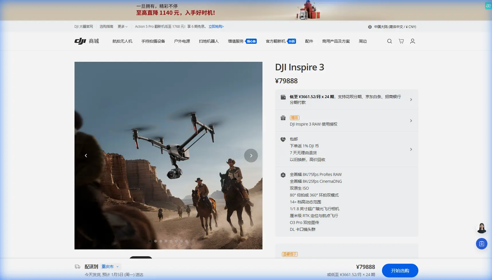
How I Survey Remote Construction Sites More Reliably With the DJI Inspire 3
META: A field-focused guide to using DJI Inspire 3 for remote construction site surveying, covering photogrammetry workflow, RTK, O3 transmission, hot-swap batteries, and secure data handling.
Remote construction surveying punishes weak aircraft and sloppy workflows. Distance adds friction to everything: travel time, battery planning, signal quality, control-point placement, and the simple fact that if something goes wrong, there is no quick reset from the truck. That is where the Inspire 3 changes the job from fragile to repeatable.
I say that as someone who has spent too many mornings trying to build a usable photogrammetry dataset from sites that were muddy, windy, partially graded, and several hours from the nearest office. I’m Dr. Lisa Wang, and the turning point for me was not one magic feature. It was the way the Inspire 3 combines several operational advantages that matter specifically for remote construction work: stable flight behavior, hot-swap battery support, O3 transmission for more dependable control and monitoring, RTK-grade positioning, and secure handling through AES-256 encrypted video transmission.
If your goal is accurate terrain models, stockpile measurements, progress documentation, and repeatable mapping passes over a remote project, this aircraft can save more time in the field than many people expect. The key is using it like a survey platform, not just a camera drone.
The old problem: losing survey quality to field interruptions
On remote jobs, the failure point is usually not the final map. It’s the chain of small disruptions that degrade the capture before processing even begins.
A typical example: you arrive after a long drive, weather is acceptable but variable, ground crews are already moving material, and your usable flight window is shorter than planned. With older workflows, a battery swap can break momentum. Reacquiring precise flight lines takes longer than it should. Signal quality may dip around terrain cuts or steel structures. If your geospatial consistency is marginal, your photogrammetry team spends the next day compensating for it with extra cleanup and more reliance on GCPs than the schedule really allows.
The Inspire 3 addresses several of those pressure points directly.
Hot-swap batteries matter because they preserve operational continuity. That sounds mundane until you are trying to maintain a disciplined mapping sequence across a large site while the light is changing. Being able to replace batteries without fully shutting down the aircraft reduces downtime and helps keep your collection pattern consistent. In real surveying terms, this lowers the chance of introducing irregular overlap, inconsistent shadows, or rushed decisions between sorties.
O3 transmission matters because remote sites are rarely RF-perfect. Open land can still produce signal challenges from elevation changes, machinery, temporary structures, and sheer distance across the active work zone. More robust transmission gives the pilot and data lead a cleaner sense of what the aircraft is seeing and how the mission is progressing. That improves confidence during critical sections of a route, especially where you need to confirm image quality before committing the whole block to processing.
And AES-256 matters more than many teams admit. Construction surveys often involve pre-release site layouts, infrastructure staging, utility corridors, and proprietary development progress. Secure transmission is not just a line-item feature. It reduces risk when sensitive project visuals are being captured and monitored in the field.
Why Inspire 3 works for remote construction surveying
The Inspire 3 is not the default answer for every mapping job. There are dedicated survey platforms better suited to high-volume, routine orthomosaic production. But on remote construction sites where conditions shift and documentation needs extend beyond flat mapping, the Inspire 3 is unusually capable.
It is especially strong when your mission has to do more than produce a map. Many site teams need:
- photogrammetry-ready image sets
- high-quality visual progress records for stakeholders
- repeatable captures for schedule comparison
- terrain and grading context around complex structures
- responsive deployment when the site changes midweek
That mix favors a platform with strong imaging performance and dependable flight operations.
The practical significance of RTK is easy to underestimate. On a remote project, every reduction in georeferencing uncertainty saves effort downstream. RTK improves positional accuracy in image capture, which can reduce the burden on correction workflows and strengthen consistency between survey dates. I still recommend GCPs for critical deliverables, especially where contractual tolerances matter, but RTK changes the economics of the day. You spend less time rescuing mediocre spatial data and more time validating a sound dataset.
A field workflow that actually holds up
Here is the how-to approach I use when the Inspire 3 is assigned to a remote construction survey.
1. Start with the deliverable, not the flight
Before touching the aircraft, define the output. Are you building a progress orthomosaic, a cut-and-fill terrain model, a stockpile volume check, or a visual record for engineering review?
This changes everything:
- For photogrammetry, your priority is overlap, consistency, altitude discipline, and ground control strategy.
- For executive or engineering progress review, camera angle, route repeatability, and detail framing may matter more.
- For grading verification, georeferencing discipline becomes central.
The Inspire 3’s value shows up when one mission has to support multiple outputs without becoming chaotic.
2. Use RTK intelligently, but do not treat it as a substitute for field discipline
RTK is one of the most operationally meaningful features in this context. Better positional integrity improves model alignment and multi-date comparison. But crews make a mistake when they assume RTK eliminates the need for a control plan.
For remote construction sites, I recommend a layered approach:
- establish a small but robust GCP network around the active survey zone
- place points where they remain visible despite vehicle movement and material staging
- verify satellite conditions before committing to a major block
- use RTK capture to strengthen the baseline, then let GCPs validate and tighten the result
That combination is often the sweet spot between efficiency and confidence. The GCPs serve as your truth anchors. RTK helps the aircraft arrive with better spatial discipline from the start.
3. Plan around battery continuity, not just battery capacity
People often ask how many batteries they need. The more useful question is how to structure sorties so the survey never falls apart between them.
Hot-swap batteries are a major advantage here. On a remote site, stopping fully to reset an aircraft can cost more than a few minutes. You lose rhythm. The crew starts improvising. Light shifts. Ground traffic changes. Small inconsistencies ripple into the dataset.
With the Inspire 3, I plan sectors that can be completed cleanly within known power margins, then use hot-swap capability to keep transition time minimal. That means:
- divide the site into logical capture blocks
- finish one block completely before changing mission goals
- maintain the same image strategy through the sequence
- avoid mixing rushed ad hoc captures into a structured photogrammetry set
That discipline is one of the hidden reasons some teams produce reliable models and others keep fighting alignment errors.
4. Use O3 transmission as a quality-control tool
Pilots often think of transmission only in terms of control. For survey operations, it is also a data quality checkpoint.
O3 transmission helps you monitor framing, environmental changes, and mission continuity with fewer surprises. On remote jobs, this is critical because re-flying a site may not be practical the same day. If a section is soft, partially obstructed, or affected by sudden glare, you want to catch that in the field, not after the team has packed up and driven back.
This matters most around:
- excavation edges with strong contrast
- steel framing and reflective surfaces
- dusty work zones
- irregular terrain that can affect line of sight
- perimeter areas where the site extends farther than expected
A cleaner live view supports better decisions while there is still time to correct.
5. Treat security as part of the survey workflow
Construction teams increasingly ask where imagery goes, who can see it, and how it is protected during active capture. That concern is justified. A remote site may contain planned utility runs, structural sequencing, access roads, and progress details that should not circulate loosely.
The Inspire 3’s AES-256 encrypted transmission is operationally useful because it helps secure the video link during field work. For firms managing sensitive project documentation, that supports compliance expectations and reduces friction with stakeholders who may otherwise resist drone capture on critical sites.
Security does not replace good internal process, but it supports it. I pair it with disciplined file naming, controlled storage transfer, and same-day backup when possible.
6. Don’t force thermal language where it does not belong
The term “thermal signature” gets thrown into too many drone discussions. For construction surveying, be precise. If your actual mission is photogrammetry and progress documentation, thermal is not automatically part of the workflow.
That said, the phrase becomes relevant when you are surveying remote sites that also require limited building-envelope review, temporary power inspection, or heat-loss checks on newly installed systems using a separate thermal platform. In those situations, the Inspire 3 can still serve as the high-quality visual and spatial capture aircraft, while thermal findings are correlated against the survey model later.
That separation matters. It keeps your survey workflow clean and avoids mixing incompatible capture goals into one rushed flight plan.
7. Build repeatability into every revisit
The real value of construction drone surveying is not one map. It is comparison over time.
Remote projects benefit when you can revisit monthly, weekly, or even after major milestones and generate comparable datasets. With the Inspire 3, repeatability improves because the platform is stable enough to support consistent route planning, while RTK strengthens positional confidence across survey dates.
That translates into better answers to practical questions:
- Is the grading progressing according to plan?
- Has the haul road alignment changed?
- Are stockpile volumes tracking site reports?
- Is drainage shaping developing as designed?
- Did the subcontractor actually complete the claimed work area?
Those are the questions project managers care about. The drone is just the means to answer them with fewer assumptions.
A realistic note on BVLOS
BVLOS enters many conversations about remote construction sites, usually because the project footprint is large and stakeholders want broader coverage. The right way to discuss it is carefully and within local regulations. The Inspire 3 may fit into advanced operational planning where legal approvals, airspace conditions, crew procedures, and risk controls support beyond-visual-line-of-sight work, but that does not make BVLOS a default mode.
For most site teams, the immediate win comes from disciplined visual-line-of-sight operations executed with better efficiency. In other words: solve the workflow before chasing the exception.
The biggest lesson from my own field work
Years ago, I lost half a day on a remote grading site because our workflow depended too heavily on a perfect sequence of battery changes, ideal signal conditions, and manual reconstruction of flight continuity after interruptions. The aircraft was capable enough on paper. The operation was not resilient enough in reality.
The Inspire 3 made that easier, not because it removed complexity, but because it reduced the penalty for inevitable field disruptions. Hot-swap batteries gave us continuity. O3 transmission reduced uncertainty while the aircraft was out over difficult terrain. RTK improved the geospatial backbone of the mission. AES-256 helped satisfy a client that was cautious about active site visibility and data handling.
That combination changed the day from reactive to controlled.
If you are building a remote-site survey workflow around the Inspire 3 and want to compare notes on GCP layout, mission design, or how to separate progress documentation from photogrammetry capture, you can message our field team here.
What I would do on day one with an Inspire 3 at a remote site
If you are deploying this aircraft for the first time in a construction survey context, keep it simple:
- Define one primary deliverable.
- Build a minimal but deliberate GCP plan.
- Enable RTK and verify the setup before launch.
- Divide the site into manageable capture blocks.
- Use hot-swap battery transitions to protect mission flow.
- Watch the live feed as a quality-control layer, not just a pilot view.
- Secure the data path and file handling from the start.
- Repeat the same structure on the next visit so your comparisons mean something.
That is the difference between “we flew the site” and “we produced survey-grade project intelligence.”
The Inspire 3 is at its best on remote construction projects when the crew respects that distinction. Used casually, it is a premium aircraft. Used methodically, it becomes a reliable bridge between field reality and decision-ready site data.
Ready for your own Inspire 3? Contact our team for expert consultation.