How to Survey Coastal Wildlife With Inspire 3 After DJI’s Ze
How to Survey Coastal Wildlife With Inspire 3 After DJI’s Zenmuse L3 Launch
META: A practical expert guide to surveying coastal wildlife with DJI Inspire 3, using lessons from DJI’s Zenmuse L3 launch to improve multi-angle data capture, flight safety, and field workflow.
DJI’s announcement of the Zenmuse L3 as its first long-range, high-accuracy aerial LiDAR system is not just enterprise news for mapping teams. For Inspire 3 operators working in coastal wildlife surveys, it signals something more useful: DJI is pushing harder toward richer aerial datasets gathered from multiple angles and in places that are not easy to reach.
That matters because coastal wildlife work is rarely neat. Mudflats shift. Nesting areas sit behind dunes and marsh grass. Salt haze softens contrast. Birds lift unexpectedly. Marine mammals surface and vanish on their own schedule. In that environment, the difference between a cinematic drone flight and a defensible survey mission comes down to process.
If you are using Inspire 3 for wildlife documentation along coastlines, estuaries, tidal inlets, or mangrove edges, the best way to think about this latest news is simple. The aircraft does not need to become a LiDAR platform to benefit from the direction DJI is heading. The operational lesson is to build your Inspire 3 workflow around two priorities the L3 launch makes explicit: long-range confidence and data collection from multiple angles.
Here is how I would approach that in the field.
Start with the real takeaway from the L3 launch
The headline detail is clear: Zenmuse L3 is DJI’s first long-range, high-accuracy aerial LiDAR system. The supporting language is just as revealing. DJI frames it around “daily tasks,” collecting data “from multiple angles,” and working “for roads less traveled.”
Those phrases have operational weight, even if you fly an Inspire 3 rather than a larger enterprise airframe.
For wildlife survey crews, “multiple angles” is not a slogan. It is how you reduce identification errors. A single top-down pass might confirm count density on a sandbar, but it can miss separation between individuals tucked into vegetation edges or fail to distinguish resting birds from drift debris when light is poor. An oblique pass, flown carefully and at appropriate stand-off distance, often resolves shape, spacing, and behavior more reliably.
“For roads less traveled” is equally relevant. Coastal survey sites are often hard to access by vehicle and awkward on foot. Tidal windows can turn a safe launch location into standing water within an hour. A drone system with strong transmission performance and predictable handling lets crews stay farther from sensitive habitat. On Inspire 3, that is where disciplined use of O3 transmission and route planning starts to pay off. The goal is not simply to fly farther. The goal is to maintain clean situational awareness while keeping disturbance low.
The pre-flight cleaning step most teams skip
Before camera settings, before waypoint planning, before battery pairing, clean the aircraft properly.
That sounds basic, but in coastal environments it is one of the most important safety steps you can take, especially on a platform with advanced sensing, high-performance propulsion, and a mission profile that may involve low-altitude shoreline work. Salt spray, windblown sand, dried mist, and fine organic debris accumulate fast. A lightly contaminated vision sensor, landing gear contact point, or battery interface can produce problems that look like software trouble when they are really contamination issues.
My standard pre-flight cleaning routine for Inspire 3 in coastal wildlife operations is this:
- Wipe down obstacle sensing windows and camera-facing surfaces with a clean lens-safe cloth.
- Inspect motor housings and arm joints for fine grit.
- Check battery contacts for residue before installing hot-swap batteries.
- Clean the underside and landing gear area where salt spray tends to settle.
- Confirm the gimbal moves freely before power-up.
This matters for two reasons. First, flight safety systems only help when their sensors are unobstructed and the aircraft is mechanically clean. Second, wildlife survey flights often require quiet precision near sensitive habitats rather than aggressive stick inputs that can compensate for poor aircraft readiness. A clean platform behaves more predictably.
On shorelines, I also recommend keeping one dry cloth reserved only for final sensor cleaning after assembly. If you use the same cloth that touched salty landing surfaces, you can smear residue onto optics and sensors without noticing.
Build your mission around low-disturbance geometry
Most bad wildlife survey flights are not failures of piloting skill. They are failures of geometry.
Inspire 3 gives you a very stable imaging platform, but coastal wildlife work demands more than stable footage. You need repeatable observation angles that preserve animal welfare and still produce usable evidence. The L3 launch’s emphasis on collecting data from multiple angles is a good reminder that one pass is seldom enough.
A practical structure looks like this:
1. Plan a high recon pass first
Use a higher-altitude overview leg to identify animal groups, human activity, tide lines, and escape directions. This first pass tells you where not to go. It also helps set safe working lanes that do not push birds toward water or force mammals into abrupt movement.
2. Add a controlled oblique pass
A second pass at a shallow oblique angle often improves species differentiation and habitat context. In coastal environments, this is especially useful around marsh margins, dune cuts, shell banks, and rocky intertidal zones where top-down imagery flattens the scene too much.
3. Keep lateral separation
Do not aim for dramatic proximity. Wildlife surveys are won by consistency, not by closeness. If subjects alter posture, bunch, flush, or orient repeatedly toward the drone, your stand-off distance is likely too tight.
4. Use repeatable lines for comparison
If the site will be surveyed again, keep track geometry consistent across missions. That gives you cleaner comparisons over time for nesting spread, haul-out occupancy, or shoreline use patterns.
This is where Inspire 3 can be stronger than many crews realize. Its imaging quality is obvious, but its real value in survey conditions is repeatable aircraft control combined with robust transmission. A stable route flown the same way each time creates data you can defend.
When photogrammetry helps, and when it doesn’t
Photogrammetry is useful in coastal wildlife work, but only if you are honest about the subject.
For habitat mapping, colony-edge documentation, erosion tracking around nesting grounds, and vegetation condition around lagoons or marsh islands, photogrammetry can be extremely effective. If you lay out GCP markers where legally and ecologically appropriate, you can improve spatial consistency for repeated site monitoring. That becomes valuable when comparing nest-adjacent terrain changes, waterline migration, or access-path erosion over time.
But live animals are not static survey targets. If your mission priority is counting or behavior observation, do not force a photogrammetry workflow where a direct imaging workflow is better. Moving birds, surfacing mammals, or wind-driven vegetation can weaken reconstruction quality and create false confidence in your output.
The better approach is to split objectives:
- Use structured image capture and GCP-supported workflows for habitat and terrain context.
- Use targeted imaging passes for counts, identification, and behavioral interpretation.
That separation becomes even more important when teams are tempted to stretch one mission into too many deliverables. News around advanced payloads like L3 can encourage operators to think every sortie should collect every kind of data. In practice, cleaner mission intent usually produces better science.
Think carefully about thermal signature expectations
A lot of operators talk about thermal signature as if it is a guaranteed solution for wildlife detection. Coastal conditions are less forgiving.
Moisture, wind, reflective wet surfaces, mixed substrates, and rapid temperature equalization can all reduce contrast. On some mornings, a mudflat may present enough thermal variation to support useful detection logic. On others, the environment collapses the separation you were expecting. That is why visual workflow discipline still matters on Inspire 3, even if your broader operation also uses thermal tools elsewhere.
The key is to understand what problem you are solving. If you need broad habitat context, shoreline occupancy patterns, and high-quality visual documentation, Inspire 3 remains a strong fit. If your mission absolutely depends on thermal discrimination, build that requirement into platform selection from the start rather than assuming conditions will cooperate.
Transmission security and operational discipline matter more near sensitive sites
Coastal wildlife projects are often conducted in places with public visibility, research sensitivity, or protected-area restrictions. Data handling cannot be an afterthought.
Inspire 3 operators should take full advantage of secure workflow habits, including AES-256 where applicable in the transmission and data ecosystem, controlled media handling, and role-based access to files after landing. That is not just about cybersecurity theater. Sensitive habitat imagery, nesting locations, and species presence records can create real protection concerns if shared loosely.
O3 transmission also deserves practical respect here. Strong video link quality is not permission to push the mission into unnecessary range. For wildlife work, reliable link margin should be treated as a buffer that supports safer, calmer operations, especially when launch points are constrained by dunes, marsh edges, or tide timing. In some jurisdictions, operators will also need to consider whether mission design intersects with BVLOS planning and approvals. If the job requires that kind of envelope, treat it as a regulatory and risk-management exercise, not an improvisation.
A useful lesson from outside DJI: manufacturing maturity shapes field confidence
There is another piece of news worth watching, even though it sits outside the Inspire 3 ecosystem. China’s “Jiutian” unmanned aircraft is reportedly scheduled for a first flight by the end of June, with a 25-meter wingspan and a maximum takeoff weight of 16 tons. More interesting than its size is the manufacturing story around it: a full-chain domestic production system spanning process design, raw material supply, and final aircraft debugging.
Why should an Inspire 3 wildlife operator care?
Because mature aerial work depends on the same principle at every scale: integration. Reliable aircraft behavior in the field comes from tight coordination between design, production, software, maintenance logic, and operator workflow. The larger UAV industry is moving toward deeper system integration, not just bigger platforms or flashier payloads. DJI’s L3 launch fits that same direction. Better sensing, longer-range confidence, and more structured data capture all point toward one reality: aerial work is becoming less about isolated flights and more about repeatable systems.
That is exactly how coastal wildlife teams should use Inspire 3. Not as a flying camera alone, but as one disciplined node in a survey method.
A field workflow that actually holds up
If I were briefing a two-person coastal wildlife crew using Inspire 3 tomorrow, I would keep it tight:
Pre-launch Clean the aircraft thoroughly, especially sensors and battery contacts. Confirm hot-swap batteries are healthy and seated cleanly. Review no-fly constraints, protected habitat buffers, and tide timing.
Initial pass Fly a conservative overview route to establish wildlife positions and identify disturbance risk. Watch for behavioral response before committing to lower or closer geometry.
Primary collection Run one nadir sequence for count support and one oblique sequence for context and identification. Keep speed smooth and route spacing consistent.
Habitat mapping If terrain or nesting-area context matters, collect a separate photogrammetry set with proper overlap and, where practical, GCP support.
Data integrity Log time, location, tide state, weather, and any subject response to aircraft presence. Secure files immediately after landing.
Post-flight Inspect for salt residue again before storage or redeployment. Coastal contamination left overnight becomes tomorrow’s reliability problem.
If you need a second set of eyes on route planning or survey setup, you can message our flight team here before heading into the field.
Why this matters now
The L3 launch is easy to read as enterprise product news and move on. That would miss the point.
DJI is highlighting long-range precision and multi-angle data collection because aerial work is being judged less by whether an aircraft can fly and more by whether the output stands up under operational pressure. Coastal wildlife surveys are a perfect example. Conditions change quickly. Access is messy. Subjects move. Small workflow mistakes ripple into bad data or unnecessary disturbance.
For Inspire 3 operators, the lesson is not to chase LiDAR just because LiDAR made headlines. The lesson is to absorb the operating logic behind the launch.
Gather data from more than one angle. Build missions for difficult terrain, not ideal conditions. Treat transmission strength as a safety margin. Keep your aircraft physically clean enough for its safety systems to do their job. Use photogrammetry where the subject is stable, not where it only sounds sophisticated. Protect sensitive data. And if your site or mission profile edges toward BVLOS complexity, solve that in planning rather than in the air.
That is how you turn a capable platform into a credible survey tool.
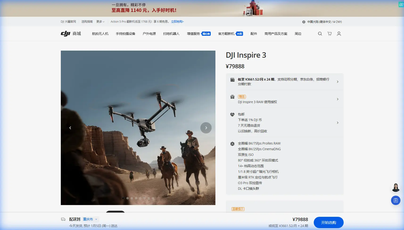
Ready for your own Inspire 3? Contact our team for expert consultation.